Amy of The World is a Book chose “A River Runs Through It” as this week’s Lens-Artists Photo Challenge, so I thought I would showcase the Copper River and its tributaries, rivers running through the Wrangell Mountains. I live deep in the heart of Wrangell-St. Elias National Park. I’m surrounded by rivers. I cross 2 rivers just to get home when I reach the end of the McCarthy Road!
Not all of these rivers are called rivers. In Alaska, some rivers are only creeks, and many creeks are big enough that they should be considered rivers. McCarthy Creek is definitely one of these.
Kayakers on McCarthy Creek
McCarthy Creek runs into the Kennicott River, the river that separates McCarthy and Kennicott from the rest of the road system in Alaska.
The only way for visitors to visit Kennicott and McCarthy is to cross a footbridge over the Kennicott River.
If you drive the McCarthy Road, one of the rivers you cross is the Gilahina. The Gilahina is a bit unusual for this region because it is not a glacial stream but a clear stream, created by snowmelt instead of glacier melt. It is also one of those rivers that might more accurately be called a creek.
Old Railway Trestle from the Copper River Northwestern Railway over the Gilahina River
Most rivers in the Wrangells are glacial streams. Glacial streams carry heavy loads of debris and silt that block the flow of the water, constantly changing its course. River beds are very wide to accommodate these changes, creating a pattern called braided streams.
The Nizina is a good example of a braided glacial river.
Wonder why so many Alaskan rivers end in na? Na means river in Athabaskan! All these streams I’ve mentioned flow into the Chitina River. Chitina means “Copper River” in the language of the Ahtna people, an Athabaskan tribe. The Chitina River is THE major tributary of the Copper River. It carries much more water than the main branch of the river. This is because it drains the southern slope of the Wrangells and the northern slopes of the Chugach Mountains within the park. The northern slopes of the Wrangells, the watershed of the Copper above the confluence, are in the rainshadow and do not receive as much precipitation.
The Chitina River
The Chitina joins the Copper River at the town of Chitina. The Copper River is one of the world’s most important wild rivers, running nearly its entire length through a vast wilderness. It’s the tenth-largest river in North America. It carries one of the greatest silt loads of any river in the world.
All that silt has built the Copper River delta at the mouth of the river, the largest contiguous wetland on the entire Pacific Coast. This area is vitally important to birds. It’s an important stop on the Pacific Flyway, one of the continent’s main migration routes. The entire world population of western sandpipers and dunlins stop here on their northern migration. The delta also harbors the world’s largest population of Trumpeter Swans.
The Copper River is also home to the best salmon in the world, Copper River Reds.
The upper Copper River and Mt. Sanford
The rivers of the Wrangells are all frozen now, but breakup will be here before we know it. Cheers to the mighty Copper River and all its tributaries!
Challenge Items: Sunrise and/or sunset, Something cold and/or hot, a bird, a dog, a funny sign, a bicycle, a seascape and/or mountain landscape, a rainbow, a church, a musical instrument, a boat, a plane, a waterfall
Mendocino Sunrise
I just shot this sunrise from the porch of the place I’m housesitting this month in Mendocino County.
A waterfall near Mendocino
Extra Credit Items: An expressive portrait of one or more people, a very unusual place, knitting or sewing, a fish, an animal you don’t normally see, a bucket, a hammer, a street performer, a double rainbow, multiple challenge items in a single image.
The view from my front porch
For extra credit I thought I would include this view from my front porch back home in McCarthy. Rainbow, mountain landscape, something cold (glaciers).
Here are a few more –
The wreck of the Peter Iredale
Sunset, seascape and boat (or at least the remains of one!)
Getting ready for the slow bike race McCarthy 4th of July
Bicycles, dog and a very unusual place – at least I think McCarthy qualifies as a very unusual place! McCarthy is where good dogs go to heaven, and sometimes it’s hard to take a picture in town WITHOUT a dog in it!
McCarthy Airstrip
Plane, mountain landscape, and something cold
Stop sign at McCarthy Airstrip
Maybe it’s not really a funny sign, but it is a bit unusual – and it gives you a good idea of just what kind of a place McCarthy is.
Another view from my front porch…
Here are some animals you don’t normally see walking up to your front porch, but one day I did. I was baking date-apple bread for a potluck and I guess it just smelled too good to resist!
My last image is a sunset in someplace hot, far, far away from my home in McCarthy.
I thought I was used to driving on narrow roads. After all, I live at the end of the infamous McCarthy Road in Alaska.
The McCarthy Road
The McCarthy Road has a reputation. It used to be considered the worst road in Alaska. Barely over one lane wide, the road had features like Hug-A-Boulder Bend, a dangerous blind corner.
The Kuskulana Bridge, a remnant of the old Copper River & Northwestern Railway, was another challenge. When it was built in 1910 the Kuskulana Bridge was the 17th-highest bridge in the United States.
Kuskulana Bridge
Thirty years ago, the Kuskulana crossing was just a couple of planks wide with no guard rails. Imagine crossing then, with the river over 200 feet below and nothing to stop you if you misjudged the width of that plank! People used spotters to make sure their wheels stayed on the boards while crossing this perilous chasm. Most people turned back.
We still had Hug-A-Boulder Bend when I moved to McCarthy, but the Kuskulana had been upgraded to a full one lane. With guard rails! The road still had a reputation, though, for potholes, mudslides, and railroad spikes turning up in people’s tires. It would still take a good 3 to 4 hours to travel its sixty miles. In the summertime. On a good day.
Times have changed. Hug-A-Boulder Bend is no more, blasted away, no longer a safety hazard. The road is wider, mostly 2 lanes now. Part of it was chip sealed, which actually made it worse when the frost heaves hit after the first year of smooth sailing. Although flats are still common, nobody finds spikes in their tires anymore. The road is graded more often, although it still can get a bit rough due to potholes, mudslides, and beaver dams. These days it only gets really bad in the winter. But it would still be considered narrow by most folks.
The McCarthy Road is still potholed and narrow.
The Denali Park Road
Another narrow road I know well is the Park Road in Denali National Park. I drove this road frequently when I worked as a ranger there for a couple of summers. Sections of the road are so narrow and hazardous that a driver needs to pull over at the wide spots to scout the upcoming curves and wait for approaching traffic. You have to go through a training session before you are allowed to drive on this narrow road.
That road is even narrower now. It is literally sliding right off the cliff because of melting permafrost. Last summer heavy rains exacerbated the problem. Mudslides stranded about 300 visitors for a couple of days until road crews could clear the debris. This summer the narrow road may not be open at all past Mile 41 as park and highway personnel search for a longer-term solution for the worst section.
The Denali Park road may be closed this summer due to geohazards caused by permafrost melting.
I thought I was used to driving on narrow roads. But this winter’s travels have put a new spin on narrow for me.
Northern California Coast Roads
This month I’m housesitting on a narrow, winding road in Mendocino County, California. I have to slow down to 20 mph for the last half mile, then completely stop and throw the truck into first gear to negotiate the steep hairpin turn into the driveway. The road is so narrow that turning out of the driveway takes both lanes and I still nearly hit the massive redwood on the other side of the road every time I leave the house. The convoluted terrain along the northern California Coast means most of the roads around here are like that, extremely narrow and squiggly.
Like Denali, geohazards such as mudslides and roads falling off cliffs complicate matters here. Some of the ways climate change impacts these roads include rising sea level and increased severity of storms.
Take a sharp left switchback at the mailboxes.
These narrow roads all feel like four-lane highways, though, when compared to the Bursum Road. This New Mexico road leads to the tiny mining town of Mogollon.
The Road to Mogollon
This is Gila River country. the mountains where Geronimo and his band lived. I can understand why he was the last chief to surrender. It’s incredibly wild terrain; challenging, rough and remote. The first time I traveled in these mountains I learned to respect just how rough and remote they could be. This year’s travels made me respect them all the more.
Mogollon is kind of a ghost town. A couple of the old buildings have been refurbished into summer businesses, and a few residents live there year-round, but walking through on a winter’s day, you probably won’t see another soul.
Which is a good thing. I certainly wouldn’t want to run into anyone coming the other way on most of the Bursum Road. It’s a one-lane road hung on the edge of a cliff, and it’s relentless. It’s a long way in between spots wide enough to pull over enough to let another car pass in the opposite direction and it’s one blind curve after another for miles and miles. It was the scariest road I’ve ever driven.
The road to Mogollon is dangerous and scary!
I couldn’t find a spot wide enough to turn around safely. I was praying, “Please let me survive this. Please, don’t let there be anyone coming the other way. I promise I’ll never come here again. This trip is not worth my life.” Just to make it even more challenging, the late afternoon sun was in my eyes on the way out. The prayers changed to “Lord, please don’t let me drive over a cliff.”
I was lucky. No one was coming the other way until I crossed the cattle guard and hit a wider pavement and safety. Right then I passed a big pickup pulling a trailer full of mining equipment headed to Mogollon. If I had left less than 5 minutes later I would have run into him at the most hazardous curve on the road. Perfect timing! Whew! The Universe heard my prayers! The Bursum Road was the scariest road I had ever driven.
I didn’t take any pictures to show you just how scary it is. There was nowhere that felt safe enough to stop. But here’s a link if you want to travel this road virtually. It’s the only paved road I’ve ever traveled that I wouldn’t drive again because I feel the risk is too great. This is one scary road.
A Little Advice
Some advice for folks traveling narrow roads, wherever they may find them. SLOW DOWN around the curves!! PLEASE slow down. Someone might be coming the other way and on most of these roads, you’re a long way from help. Just sayin’.
For this week’s Lens Artists Photo Challenge, Patti invites us to go on a scavenger hunt, looking for the color red.
Well, I didn’t have a lot of luck. Contrary to the name, the redwood forest does not have a lot of red, especially in January, and that just happens to be where I am this week.
Bunkhouses on National Creek
I thought to myself, “Gee, I don’t really have a lot of red in my life”, and then it struck me. Oh, duh, I actually have a LOT of red in my life, since I work in the red-and-white town of Kennecott, Alaska during the summer.
The last time this building was painted was in 1938!
Kennecott, a company town, painted most of their buildings red. The reason? For the same reason so many barns used to be painted red. Cheap red paint lasted a long, long time. Some of the buildings at Kennecott haven’t been painted since the mines shut down, in 1938.
Fall Colors on Fireweed Mountain
Another place where red crops up in my Alaskan life is fall. Lots of bushes turn red in the fall, and of course, there are also berries. Blueberries aren’t the only berries to be found here, and most of the others are red.
Highbush Cranberries
When I travel south for the winter, I find other shades of red – sunsets, for instance.
Pacific coast sunset
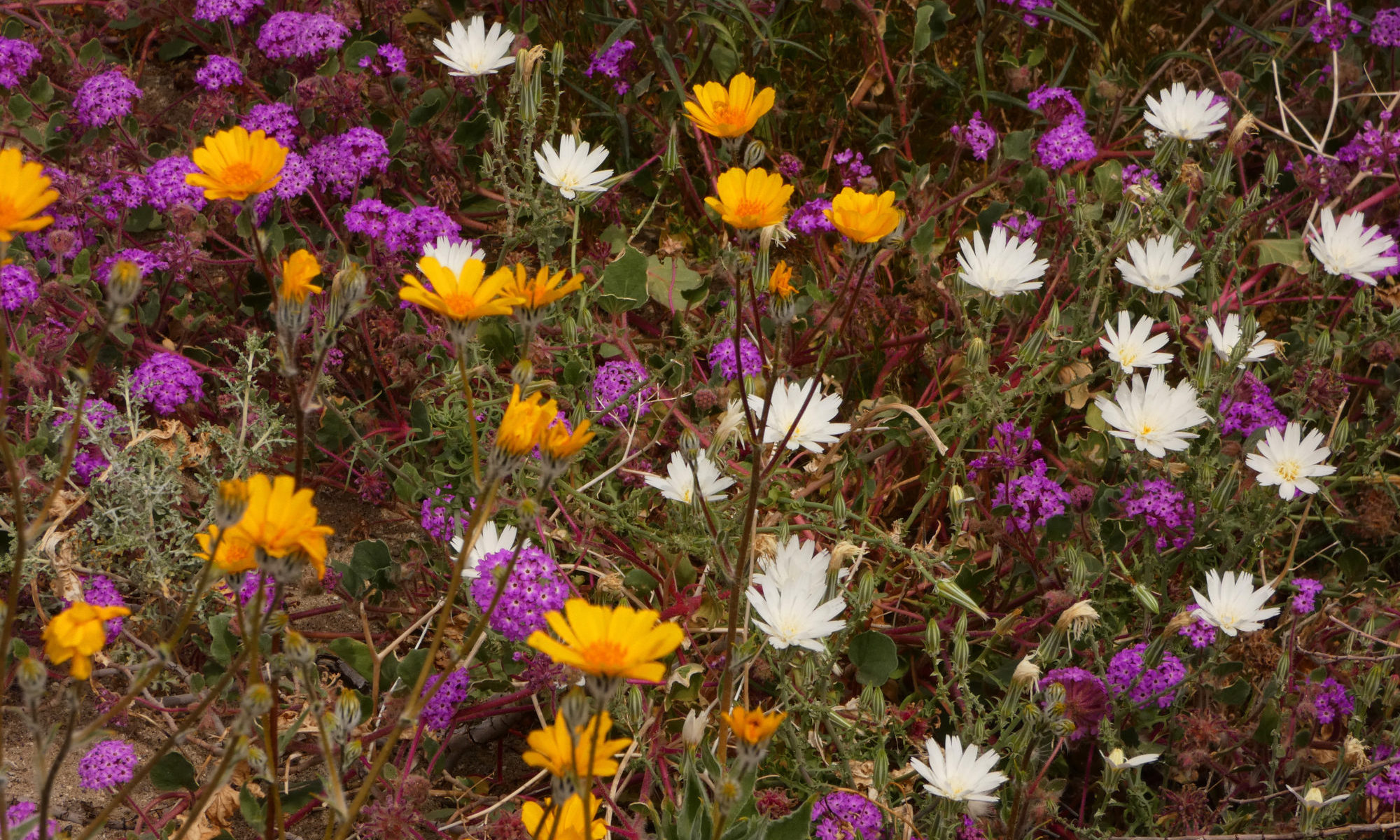
I also sometimes see red when the desert wildflowers bloom. Look for Desert Paintbrush in Death Valley, and Ocotillo and Chuparosa in Joshua Tree and Anza Borrego.
Ocotillo
Speaking of the desert wildflower season, this should be a good year just about everywhere. I’m not predicting a superbloom, but even Death Valley has gotten a fair amount of rain. When I passed through there last week, I saw little seedlings coming up all over. We even found a Turtleback with a few blossoms already. The valley floor should be looking good by mid-February, and Jubilee Pass will be at its best around early March.
Look for Paintbrush in Death Valley in March.
Of course, another little rain wouldn’t hurt. And too much wind or a drastic return to high temperatures will desiccate those little baby plants.
Chuparosa
Further south, both November and December brought an abundance of precipitation, with Anza Borrego receiving over an inch of rain in one storm. The forecast for this spring, though, is drier than average. Once again, the amount of sun and wind will play a big part in just how special the wildflower season will be or how long it will last.
Happy New Year! Patti of Pilotfish has presented us with a delightful yet difficult challenge this week -Favorite Photos of 2019. How do you choose? It isn’t easy.
I got distracted a lot as I browsed through thousands of photos, with an image catching my eye and sending me into a memory. Focus, Di, focus! Don’t go down that rabbit hole! Is it really one of your 10 best of the year?
In the end, I couldn’t do it. I could narrow it down to 40 or so, but 10? Impossible!
So I took a page from NatGeo’s book. I COULD narrow it down to my favorite 10 unpublished photos of the year, ones that for one reason or another had not made it onto a blog post.
I’ll do this directionally. I’ll start in the northwest and make my way down towards the southeast.
Matanuska Sunrise
Matanuska Valley, Alaska
I had an early morning doctor’s appointment. However, it was a 7-hour drive from my home in remote rural Alaska to the doctor’s office. So I left after work, drove part way, slept in the back of my truck, and continued on my way just before the crack of dawn. My reward was a beautiful sunrise over the Matanuska River, one of the most spectacular sunrises I’ve ever seen. My photos don’t do it justice, but here’s my best shot at it.
Life in the Wrangells
Wrangell-St. Elias National Park
We have some really big mountains in the Wrangells. In fact, Wrangell-St. Elias has more mountains over 14,500 feet than anywhere else in North America. Furthermore, unlike Colorado’s 14-ers, Alaska’s mountains start from a lot closer to sea level! They are REALLY big mountains. I like this image because you get an impression of just how big they really are.
Stone Sheep
Stone Mountain Provincial Park, British Columbia
My favorite day when I drive the Al-Can Highway is the day I drive through Stone Mountain and Muncho Lake Provincial Parks. They are both home to the somewhat rare and beautiful Stone Sheep, and if I’m lucky I might see one. This year I was able to shoot this environmental portrait of a ram doing what Stone Sheep do best, climbing cliffs.
Swallowtail
Electra Road near Jackson, CA
Although I’m usually raving about the wildflowers in the desert, by the time April rolls around you’ll find fantastic wildflowers in the Sierra foothills, too. That’s where I captured this image of a swallowtail butterfly sipping nectar from a flower.
The Mighty Ocean
Point Pinos, California
I think this is my new favorite photo of 2019. I don’t know why I never noticed it before. I was trying to capture the power and fury of a winter storm on the Pacific coast. Big waves. I can watch them all day.
Lovers
Piedras Blancas, California
One of my favorite photographic experiences of 2019 was watching the elephant seals at Piedras Blancas. It was a true wildlife drama, with hundreds of seals birthing, mating and fighting just yards away from their human voyeurs. As I watched, the seals struck me as some of the most ill-tempered animals I’d ever seen, always fighting and arguing – all of them, not just the bulls. Mating, in most cases, seemed exceptionally harsh and brutal. This couple was the exception. They seemed, dare I say it, actually content and peaceful with each other! I tried to capture that feeling.
Pink-Flower Hedgehog Cactus
Joshua Tree National Park
If you follow my blog at all, you know that no roundup of my favorite photos of 2019 would be complete without at least one closeup of a desert wildflower. I love getting up all close and personal with cactus blossoms. They’re exquisite. I found this one in Joshua Tree National Park.
Sunrise in Coachwhip Canyon
Anza Borrego State Park, California
Because my little Toyota truck is only 2 wheel drive, sometimes my dispersed camping options are somewhat limited. I find myself returning to one particular campsite in Anza Borrego again and again. But even though flowers are going crazy in the rest of the park, there are usually very few or no flowers in my favorite canyon. This year was different. This year, my camping canyon was one of the park’s wildflower hotspots. I took this photo from the hill behind my camp.
Arizona Sunset
Tucson, Arizona
There’s a reason Arizona is famous for its sunsets. Just sayin’.
Well, I had a hard time picking my favorite. And I find it hard to be objective. Each image is colored by the experience that accompanied it.
How about you? Which one is your favorite? Let me know in the comments.
As I look back over 2019, I feel fortunate. I had some incredible opportunities to spend time in a few of our country’s most amazing photography destinations. Some were popular places, in danger of being loved to death. Others were just as special, but not as well known, the kinds of places that creep up on you and get under your skin. Forever.
I thought I’d make a Top Ten list, it being close to the New Year and all. But I found I couldn’t narrow it down to just ten places. So I came up with a baker’s dozen. Then my post was too long. So I broke it into parts 1 and 2, the Rambling Ranger’s favorite photography destinations of 2019. Here is Part 1.
13) Elkhorn Slough / Moss Landing
This spot is one of those best-kept secrets. It’s a location that skates by under the radar on a coastline filled with destinations that are a bit TOO popular (Big Sur, Point Lobos, Monterey). Although Elkhorn Slough doesn’t have the flashy scenery of those more fashionable destinations, the wildlife watching here is fabulous. Look for a plethora of shorebirds. The main draw, however, is the sea otters. This just may be the best place on the Pacific coast to observe those cute little critters.
Sea Otter Waving
12) Death Valley National Park
I spent most of March in Death Valley. I had committed myself months earlier to leading a few hikes there, before I could predict where the best desert wildflowers would be. The flowers were very late in Death Valley, with only a few blooming in March. It drove me a little crazy to be stuck there, as I knew that both Anza-Borrego and Joshua Tree were experiencing exceptional blooms.
But the great thing about Death Valley is that it is an amazing photography destination even if there are no flowers blooming. The austere beauty and diversity of landscapes offer endless opportunities for inspiration and creativity. I saw a few new places and revisited a lot of old favorites, too.
Death Valley National Park
11) Southern Colorado Rockies
I had a short housesit in Durango over Thanksgiving this year. It’s always a blessing to spend time in southern Colorado. I love that edge environment, where the mountains meet the desert, giving you the best of both worlds. From the Great Sand Dunes to the many hot springs, from the jagged ragged peaks of the Rockies to the mesas and canyons of the Colorado Plateau, there were so many choices, all within a day’s drive of my base in Durango. The southern Colorado Rockies are another place I find myself returning to, again and again.
Durango is beautiful.
10) Denali Highway
This is one of my favorite places to see the fall colors in Alaska. And Alaska often has some OUTRAGEOUS fall colors! The blueberries are pretty incredible on the Denali Highway, too! Late August to early September is the time frame to aim for if you want to see the tundra put on its fancy dancin’ clothes. Special bonus: You might get lucky and see that visual symphony, the Aurora, too!
Fall colors along the Denali Highway
9) Rocky Mountain National Park
Rocky has a special place in my heart because I lived in both Estes Park and Grand Lake long ago in my younger days. I was fortunate to land a housesit in Allenspark, at the southwest corner of Rocky Mountain National Park, in October. It was a blast from the past, revisiting the environment that first instilled in me my deep love of the mountains.
Rocky is one of the best places in the country to catch the elk rut. It is also home to superb alpine scenery, wonderful hikes, and brilliant aspens. One thing to keep in mind – like Arches and Zion, this park is in the process of being loved to death. Be aware of your impact. Choose the trail less traveled. Give the animals their space and leave no trace so that we can all continue to enjoy Rocky for generations to come.
My old stomping grounds
8) Point Pinos
Storm watching. Big waves. That’s why Point Pinos, in Pacific Grove, California, made my list. This is the first place I’ve ever been at all successful at capturing the essence of the power of the ocean. The surf here is awesome, in the original sense of that word.
Pacific Grove was also a place of great sadness for me, where I witnessed the crash of ecosystems, both terrestrial and maritime. The near-extinction of the Monarch Butterfly and the exponential effects of sea star wasting and a warming ocean were only too apparent during my stay here. Although it was heartbreaking, I felt it was important to be a witness.
Point Pinos is a great place to watch the big waves.
7) Tucson, Arizona
There’s a reason why Arizona sunsets are famous. I swear they’re the most lurid sunsets I’ve ever seen! I love the cacti, too, stately saguaro and crazy cholla. I spent a few weeks in Tucson on a housesit last February and was surprised at how much I liked it since I’m not much of a city girl. But national and state parks abound, as well as other great open spaces.
Crazy cholla
These were just a few of my favorite photo destinations for 2019. I’ll let you in on the rest by New Year’s Eve. What were some of yours? Let me know in the comments!