Isabelle -1928 -2022

We laid my mother to rest this weekend. I wanted to make this final tribute to her.

Isabelle and her mother, Noelle

She came from humble origins. Her father never learned to read and write, or even sign his name. He never went to school. He had to start working at the age of 5 to help support his family – brutal, dirty work, sweeping out coal boilers in the mills.

Her mother was an immigrant, part of the mass movement of Quebecois traveling south to work in the textile mills of New England. Entire villages relocated, searching for a better life in America.

Izzy as a child

As an only child growing up among immigrants, Isabelle spoke French before she spoke English. She didn’t learn English until she was enrolled in St. Clare, a boarding school established by an order of nuns called the Religious of Jesus and Mary.

At St. Clare, Isabelle discovered one of her greatest passions, music. She had a happy-go-lucky, fun-loving spirit. Under her photo in her yearbook is an inscription: “Blessed with a cheerful spirit and sweet voice, Isabelle sings her way through life with very few cares to annoy her.  Her love for music and good reading is the source of many golden hours spent in very pleasant and useful company.  Generous and willing to help others, she is glad to cooperate with her classmates on any occasion. “

Isabelle as a young woman

Upon graduating from high school, Isabelle dreamed of a career in music, training to be an opera singer. She even sang on the radio! She gave up her dream when she met the love of her life, Richard.

Isabelle and Richard began as pen pals. He was in the Army Air Force, stationed in Japan. A friend of hers was writing him, but when she decided to get married, she passed on the task of cheering up the lonely soldier to Isabelle. In his first letter to her, he writes: “Isabelle – That’s a fine name. It has the feel of silver and gold, shining in the sun.”  Turned out she was silver and gold to him. When he came back to the States, he showed up on her doorstep with a box of chocolates and flowers. The rest is history.

Richard and Isabelle

At Richard’s side, Isabelle discovered another of her great life passions, travel. It’s a good thing she liked it!  After they made the big move West to what they called God’s Country, they had to move often, lock, stock and barrel with all the kids in tow, as Richard was transferred from one branch to another of the business he worked for; Denver, Cheyenne, Pueblo (twice), Albuquerque, all up and down the Front Range of the Rockies.

Mom with all her kids and her parents, too

She was always eager to see new places and revel in their beauty; first with her husband Richard, then with her family, and after Richard died, with her best friend Terry. Over the years, she covered all 50 states, Canada, Mexico and the Caribbean. In 2006 I helped Isabelle achieve her dream of becoming a world traveler by taking her to the #1 spot on her bucket list, New Zealand. She absolutely loved New Zealand. In a compromise between my backpacker, sleep-on-the-beach lifestyle and Izzy’s time-share condominium lodging preferences, we stayed in private rooms at hostels and little cabins along the way. When it was time to catch the plane home, Isabelle cried. She was having so much fun she didn’t want to leave. She said, “But I feel so young here!”

Isabelle in New Zealand

Isabelle was a hard worker. Although she enjoyed a few years as a stay-at-home mom, she usually worked full-time, often more than full-time. Juggling all the responsibilities and challenges of home, work, and raising 6 kids was far from easy. But Isabelle, selfless and incredibly competent, was up to the task.

She was devoted to the Catholic Church and made another dream come true when she met Pope John Paul ll while volunteering for World Youth Day. She was active in church affairs, especially the choir.

Isabelle held an annual pass to the Arvada Center and one of her greatest pleasures was attending nights at the theater or symphony with friends. Family was the most important thing in her life. She would never miss an opportunity to see a grandchild perform.

The last few years were difficult for her. She was battling dementia and had moved into an assisted-living center.  The move worked out well until Covid hit and her family could no longer visit or take her for outings. With isolation, her dementia quickly progressed. She no longer had much to look forward to. She was tired. It was time for a new adventure, the greatest adventure of them all.

Isabelle in her 90s with her daughter Carol

She was the matriarch of the Milliard clan. Perhaps some of you have seen the Netflix series, Vikings. Isabelle was a lot like Lagatha – the supreme shield maiden, the protector of all in her clan, (for her children, the arbiter and enforcer of the law!) – the queen: a legend in her own time, and one who touched all who knew her and made them better people by her example, her cheer and her love.

Thank you, Isabelle. Knowing you has been a pleasure and a privilege. We will miss you deeply but we celebrate you now – the many things you accomplished, the many dreams you made come true, the many souls you have touched. You will always live on in our hearts.

Me & my Mom circa 1990


Driving the McCarthy Road in the Sweet Light

Wrangell St. Elias National Park

I love the McCarthy Road. The road drifts east 60 miles from Chitina to McCarthy, a tangled dance of Park, private, Native and State lands. It’s a bit on the raw side. If you make it in 2 hours, you had a very good day. Most days it takes about three.

McCarthy Road
Wrangell Mountains in the Sweet Light

I don’t think I’ve ever made it in 2 hours. I like to take my time. It helps me make the transition from laid-back McCarthy to the modern world.

It used to be called “the worst road in Alaska”. The first year I was here, every time my friend Jill drove the road, another part fell off her car. After 2 summers of losing pieces, she was done. Back then, travelers understood that the journey was just as important as the destination. A trip down the McCarthy Road was an adventure in itself.

Leaving Chitina, you pass through a one-way cut, remnants of an old railway tunnel. It’s a kind of gateway, your first clue that the McCarthy Road is a different kind of drive. Around the corner, you get your first glimpse of BIG water, the confluence of the Chitina and Copper Rivers. It’s the 10th largest river in the U. S. in volume and the only river in Alaska that’s longer is the Yukon.

Copper River, Alaska
Copper and Chitina River confluence in early spring

The Copper is famous for its fishery. Copper River Red salmon is regarded as one of the finest salmons in the world. At the bridge is a State subsistence fishery, so people come from everywhere on Alaska’s road system to try their hand at dipnetting for some prime fillets and a few fish to can or smoke for the winter. Upstream you can look past a jumble of local fish wheels to the glowing snows of Mt. Drum.

McCarthy Road
Summer sign for the MXY Road

Cross the Copper and there’s the sign. It’s a warning sign – Are you SURE you’re ready for the McCarthy Road? The sign is a lot more severe in the winter “Travel on this road is NOT recommended. Expect avalanches, road glaciers, extreme cold…” Be prepared for any eventuality. You’re a long way from nowhere.

Right after the sign, the road climbs the Kotsina Bluffs, a microcosm of future challenges. The washboard on the way up the hill will rattle your parts off. Skinny road, steep cliff, no guardrails, and mudslides sloughing off the hill to the right.

Kotsina River, Wrangell St. Elias National Park
Kotsina Bluffs

The Kotsina River has recently changed course, crossing its broad floodplain to erode the bottom of the bluff directly below you. Look for the half-buried RV near the Copper, stranded and then inundated when the Kotsina made its sudden detour. But maybe you’d better keep your eyes on the road, watching for potholes, falling rocks, or oncoming traffic around the next curve.

At the top of the bluff, you hit the chipseal. A few years ago, the DOT chipsealed most of the first 17 miles of the road, from the top of the bluffs to the Kuskulana. We warned them this wasn’t the best idea. Within a year it was a minefield of horrendous potholes and frost heaves so bad that entire sections of road had just fallen away. The “improvements” haven’t changed the character; you still have to pay attention.

Chitina River Overlook, McCarthy Road
Chitina River

After a few miles, pull over for a scenic view of the Chitina River. I get a warm fuzzy feeling when I look at that vast wilderness upstream and realize I’m going into the heart of it.

Wrangell - St. Elias National Park
Ponds along the McCarthy Road

Travel past permafrost ponds filled with ducks, beaver and water lilies, catching glimpses of Mt. Blackburn through the trees. Wild roses form hedges along the side of the road.  At the end of the chipseal is the Kuskulana Bridge.

This was the 11th highest bridge in the United States when I was built in 1910. It’s a long way down. How long? Grab a couple of rocks, the bigger the better. Walk to the middle of the bridge. Drop them. I like to drop one on each side. Listen for the sound of the impact. You’ll listen for a little longer than you thought it would take. Yeah, it’s a long way down.

McCarthy Road
Kuskulana Bridge

Back in the 1980’s, the crossing was 2 planks. No guard rails. You needed a spotter to make sure your tires stayed on the boards. Not many people made it to McCarthy back then.

In the ‘90’s, you could occasionally bandit bungee jump off the Kuskulana Bridge. Word would go out through the grapevine – tomorrow – bungee jumping on the Kuskulana… It was free if you went naked, and a party even if you didn’t jump.

Wrangell - St. Elias National Park
Traveling slow on the McCarthy Road

Back in those days, we all traveled slow on the McCarthy Road. It was a one-lane road then, gravel all the way, and the road crew didn’t make it out our way very often. Only one or 2 RVs a year made it all the way down back then, and we all thought they were crazy. Traffic was so light that when you saw another car you stopped to pass the time of day. I kind of miss those days.

There are rewards for going slower. Less dust, more wildlife. One of my favorite spots for viewing wildlife are the ponds and marshes just west of Chokosna. This is the best spot on the road for Trumpeter Swans.

Trumpeter Swans on the McCarthy Road, Wrangell St. Elias National Park
Trumpeter Swans

Sometimes you get lucky and the parents bring their little cygnets close to the road for you to see and photograph. The reflections of the surrounding mountains on the water are sublime. And if you hit this patch, as I often do, at the sweet light time of the evening… You, too will fall in love with the McCarthy Road.

One spring I saw an eagle eating a duck here. Last week an eagle practically landed on my windshield on the Kotsina Bluffs. Raptors, waterfowl, songbirds, the McCarthy Road is a birdwatcher’s delight.

Moose on McCarthy Road

It’s no Denali, but wildlife sightings are frequent. Moose sightings are common. Twice I’ve seen a wolf, once a lynx. Some lucky souls have seen bison recently near Chitina, stragglers from a small herd of Plains Bison introduced to the Copper River in the 1930’s. There are bears, too.

One of my all-time favorite wildlife sightings on the road was a massive grizzly bear in the Crystalline Hills. I followed gargantuan piles of scat and footprints for about a mile before I saw him. He continued to nonchalantly plod down the road in front of me for another half mile before eventually turning into the brush. That dude OWNED the road!

McCarthy Road, Wrangell St. Elias National Park
Gilahina Trestle

The Gilahina Trestle marks the halfway point. This is the prettiest part of the road in the fall when the aspen turn.

Music is an important part of a McCarthy Road trip for me. Good tunes add to the already abundant joy. Some tunes are especially suited to the drive. I like to have Leftover Salmon’s “Dance on Your Head” in my I-Pod feed as I approach McCarthy after a long absence – “There’s no stopping this party, cuz this is a festival town”.

Crystal Lake, Long Lake, and you’re on the home stretch. Although it’s been a long drive, you still have to pay attention. The last 10 miles are the roughest.

McCarthy Road, Wrangell St. Elias National Park
Beaver Dam in the road

The marsh near the DNR rest stop is my favorite place to see moose. Earlier this summer I saw a moose family reunion there, 8 moose in one place, from the oldest, grayest, Grandma moose I’ve ever seen to a newborn calf. You never know what’s around the next bend on the McCarthy Road.

When Porphyry and Sourdough Mountains dominate the view, I know I’m almost home.

McCarthy Road, Alaska
Mudslide on McCarthy Road

Just a mudslide or two and a few hellacious potholes and I’ll be there – there being the Kennicott River. It’s still 3 miles on the ATV to my house, but that’s another story.

Thoreau said “The rougher the road, the finer the filter.” I like the McCarthy Road being rough. Keeps out the riff-raff. Makes people slow down and pay attention. I love the McCarthy Road, potholes and all. It’s always an epic journey to me.

Porphyry and Sourdough Mountains, Wrangell St. Elias National Park
The Homestretch
Beautiful Jacob's Ladder
The flowers are nice, too!
McCarthy Road
It’s one stunning view after another.


Help Save Our National Monuments!

What do our National Monuments mean to you? Do you think of them as places to play, to recreate and enjoy the beauty of our public lands? Do you think of them as places that protect the past, conserving prehistoric fossils and Ancestral Puebloan ruins? Do you think of them as “mini-National Parks”? Do you think of them as a way to offer important American landmarks a level of protection?

Mt. San Jacinto
Santa Rosa & San Jacinto National Monument

There’s a bill before the House right now you should know about. It’s HR 3990, The “National Monument Creation & Protection Act”.

Don’t let the title fool you. It’s not about national monument creation. It’s about national monument destruction and the evisceration of the Antiquities Act.


Valley of the Gods, Utah
Bear’s Ears National Monument

A Few Provisions of this Bill:

  • It would change the language, striking “historic landmarks, historic and prehistoric structures, and other objects of historic or scientific interest” and inserting “object or objects of antiquity”.
  • Limit the size of any new national monuments, in some cases to no more than 640 acres.
  • Limit a national monument’s proximity to other national monuments.
  • The President could remove up to 85,000 acres from existing national monuments, even more with agreement from a state’s governor and legislature.
  • Prohibits national monuments that protect oceans.
Gold Butte, Nevada
Gold Butte National Monument

A Little Historic Background

There are a few misconceptions out there about what the Antiquities Act is all about. Even in the very earliest days of the Antiquities Act, the “scientific interest” clause was important. Of the 18 national monuments created by Theodore Roosevelt, one third were created to preserve places of scientific interest. Proponents of this bill state that the Antiquities Act was only created to preserve objects of antiquity.

Proponents of this act state that the original act was meant to preserve only small areas. Is the Grand Canyon a small area? Fully half of our national parks started out as national monuments, most in excess of 85,000 acres at their creation as national monuments.

Sunset at Grand Canyon
Grand Canyon National Park

Think of Zion, Canyonlands, Death Valley, Olympic, Katmai, Wrangell-St. Elias, just to name a few. If the Antiquities Act meant what proponents of H.R. 3990 believe it does, none of these crown jewels would have ever received protection. Just think of the loss to our national heritage if these lands had not been protected!

The most troubling clause of this bill is the ability of the president to drastically reduce the size of existing national monuments. This means that any of our national monuments can be arbitrarily reduced by up to 85,000 acres at any time and for any reason. Essentially it means a national monument designation is no protection at all.


T Rex Skull, Dinosaur Ntnl. Monument
Dinosaur National Monument

It’s Not All Bad News

There is a ray of hope. New Mexico’s Senator Tom Udall has sponsored another bill, S. 2354, the Antiquities Act of 2018. This bill reaffirms and strengthens the original Antiquities Act and will demonstrate the public’s support for our national monuments. This bill currently needs more sponsors.


Sand Canyon, Canyon of the Ancients, Colorado
Canyon of the Ancients National Monument

What You Can Do

  • Educate yourself about just how important the Antiquities Act and our National Monuments are. Here’s a link to get started.
  • Write your congressman. Let them know that you support the Antiquities Act and do not support HR 3990.
  • Write your senators. Let them know you support the Antiquities Act and Senate bill S. 2354 and ask them to help sponsor this bill.
  • Donate to organizations that are fighting the repeal of the Antiquities Act.
  • The BLM is preparing management plans for the reduced Bear’s Ears and Escalante-Grand Staircase National Monuments proposed by Trump, even though the court cases challenging the legality of this action have not yet been heard. There is a comment period open until April 11. Protest this action. Comments must be sent individually for each National Monument.
    TeePee Rocks, Grand Staircase, Utah
    Grand Staircase-Escalante National Monument

    Make comments for Bear’s Ears and Grand Staircase/Escalante here.

  • Spread the word! Tell your friends and neighbors about this unprecedented threat to some of our most sacred places.
  • Be an activist! Organize or join a rally or demonstration in support of the Antiquities Act.

Our national monuments have never been so endangered. It’s up to us to speak up and let our voices be heard. Time is short. Let our government know now how much you care about our public lands.


Invasive Wildflowers of the California Coast

Sea Figs on Glass Beach, Ft. Bragg

Ahh, northern California! What a lovely place! And such a temperate climate! Neither too hot or too cold, too wet or too dry. Goldilocks would have said it was “just right”.

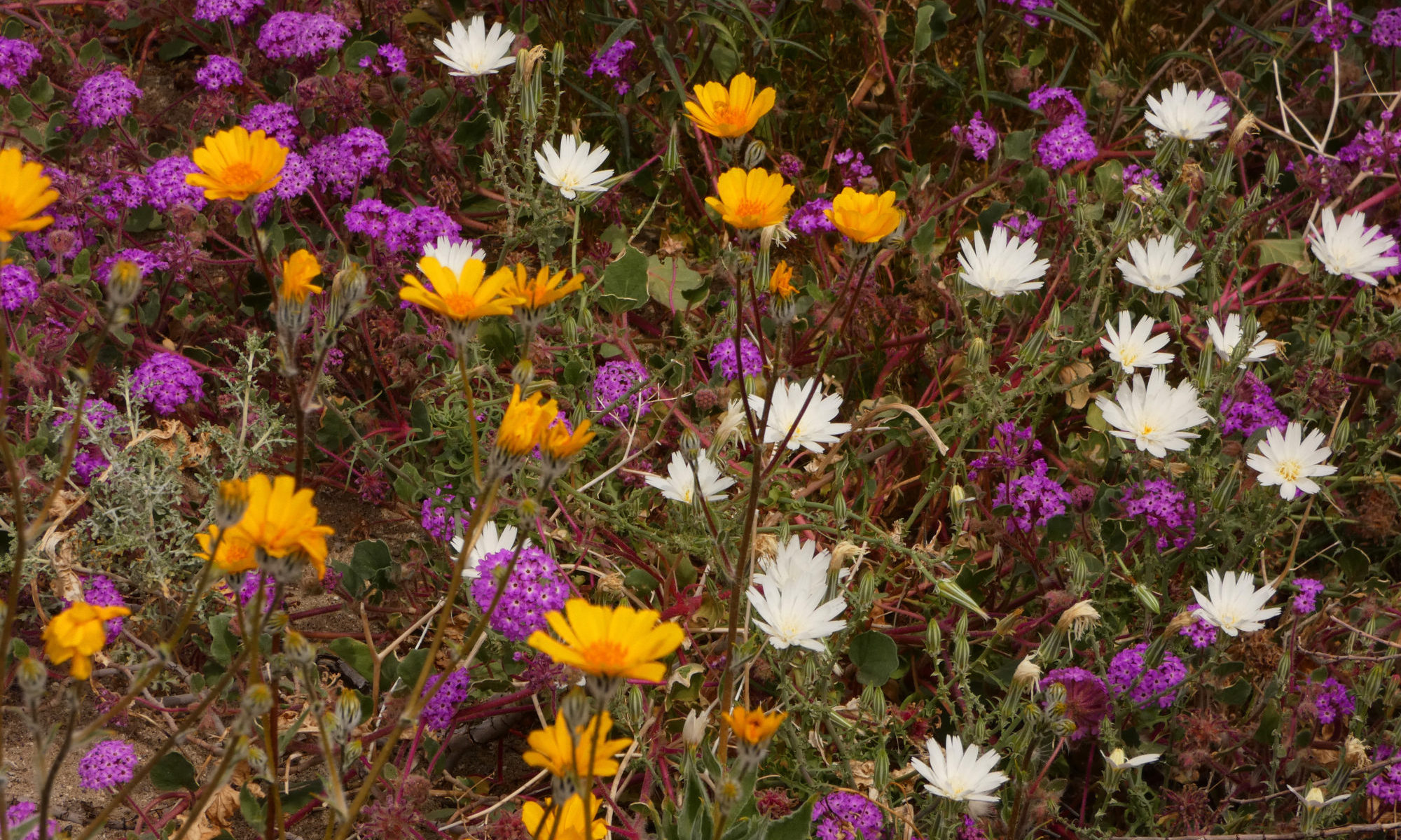
Since the wildflowers are rather sparse in the desert this year, I’m spending time on the California Coast, where there are lovely wildflowers. I was surprised to learn, though, that a lot of the loveliest wildflowers on the coast are actually weeds! California shares this problem with Hawaii and New Zealand. Some of its most prolific invasive plants are so beautiful, it’s hard to think of them as heinous invasives.

PointReyes National Seashore
Sea Fig

Even before the days of the gold rush, people of European descent thought this was a perfect place to call home. Many of them wanted to bring a little taste of their old home here with them, in the form of some of their favorite flowers. They planted them in their gardens, and many of these plants from another continent also found the living conditions “just right”. They went wild, spreading far and wide. The living conditions were so perfect, they overran the flowers that were already here, taking over their lands in much the same way that the Europeans that planted them took the lands from the Native Americans who were already here.

Most of the flowers you think of as synonymous with the California Coast are actually invasives. These invaders are so successful that now we call most of them “naturalized”, instead of invasive. They’re here to stay, no getting rid of them except in select small parcels set aside specifically for native plants.

Since they ARE here to stay, we might as well enjoy them. One good thing about their being non-native – it’s OK to pick THESE particular wildflowers! Here’s a guide to some of the California Coast’s most popular invasives.

Periwinkle

Mendocino Coast
Periwinkle

Here’s what “Wildflowers of Northern California’s Wine Country & North Coast Ranges” has to say about the Periwinkle: “It causes displacement of native species, erosion and bank destabilization, and is a host for the insect pests Sharpshooters which carry a pathogen of vineyards and orchards…. This is not a plant for the garden.

Wow. Sounds like a nasty plant. Sure looks pretty, though. Definitely feel free to pick this one, but it won’t do much good. It spreads through its roots much more than it does by its seeds.

Ice Plant

Wilder Ranch State Park
Ice Plant

This succulent comes from South Africa. Raised cells on its stems and branches that glisten in the sunlight are why it’s called ice plant. It has thin and scraggly petals that turn from white to pink as they age, and thinner leaves than the very visually similar Sea Fig. Now in the Fig/Marigold family, it was originally classified in the Carpetweed family. When you look at how it grows, it’s easy to see why.

Wild Radish

Point Reyes National Seashore
Wild Radish

This is a crucifer, related to the Mustard family, the biggest group of invasives in California. It is the most widespread and prolific invader in the state.

Unlike the domestic variety, it’s not the root you eat on this one. It’s the fat, wavy seedpods. There are a few different species that usually grow in close proximity and hybridize.

Wild Garlic

Glass Beach, Fort Bragg
Wild Garlic

Since we’re getting culinary here, thought I’d mention Wild Garlic. There are many native wild onions in California, but this is not one of them. It’s best to eat before it flowers. The whole plant is edible.

To me, these delicate bells look, but don’t smell, like they should be in a wedding bouquet!


Bermuda Sorrel

Wilder Ranch State Park
Bermuda Sorrel

Also known as Bermuda buttercup, fields and fields of these flowers bring sunshine even on a cloudy day all winter long. But they don’t bring sunshine to native plants and animals. As they drive out the native plants that local animals depend on, it becomes a monoculture. Hawks, owls and coyotes soon leave, as the rodents they depend on get scarce. Bermuda Sorrel is almost impossible to eradicate, and the areas it colonizes soon become great golden wastelands.

Bermuda Sorrel is originally from Africa. It is a relative newcomer, only beginning to be a problem in the 1980’s. Now many invasive plant experts consider it the most dangerous invasive on the coast.

Another name for this plant is sourgrass. It makes an interesting addition to a spring salad, but use it sparingly. An oxalis, this plant can be toxic if eaten in too great a quantity.

Sea Fig

Point Reyes National seashore
Sea Fig

Another native of South Africa, Sea Figs and their close relatives Hottentot Figs were brought over in the early 1900’s to stabilize ground by railroad tracks. It seems this plant decided that a day at the beach was better than workin’ on the railroad (I’d have to agree!), because it soon spread to the Coast and really took over. This plant is now ubiquitous with the California Coast. By the way, the Sea Fig IS a member of the Fig family and does have a fruit, but it doesn’t taste especially good.

Scotch Broom

Jughandle State Reserve
Scotch Broom

I hate this plant. Think of a cross between a cactus and a thistle. Not a pretty picture, huh? It’s a good description of the Scotch Broom, a very thorny bush that grows in inpenetrable thickets. This is one nasty plant. It will poke and stab you if you get anywhere near it. If you want to pick some for your invasive bouquet, better wear some stout gloves!

It’s horribly invasive. It is invasive all up and down the West Coast. Not only does it overrun coastal areas, it grows in disturbed ground where timbering has been done, outcompeting tree seedlings and not allowing the forest to grow back. It has cost the timber industry $47 million a year in Oregon alone! This is the worst invasive plant in New Zealand, where it has overrun the entire country. Now you know why I hate this plant. But it is pretty.

Calla Lily

Salt Point State Park
Calla Lily

Another South Africa native, these, along with daffodils, are garden plants gone feral. I have a hard time considering them invasive, although, of course, they are. They are not nearly as bad as the other invasives in this little guide, though! I’d rather just think of them as “introduced”.

The trouble with all these plants is just that they’re a bit too successful. They outcompete the “little guys”, the more delicate natives. Many form mats and propagate through their roots, leaving no room for the native plants to grow. It doesn’t mean they’re not interesting plants.

Cabrillo Point Lighthouse State Park
Daffodils

I’ll do a post on the native wildflowers in April. Until then, enjoy the beautiful weeds of the California Coast. Remember that by definition, a weed is just a plant growing where someone doesn’t want it to grow. “Would a rose by any other name smell as sweet?”


Dispersed Camping is the Way to Go!

There are a lot of different interpretations to the word “camping”. To some folks, living in an RV, parked in a glorified parking lot on a cement pad with a tree or narrow strip of grass just big enough to set up a lawn chair suffices. I think this may be the official definition of camping these days, judging from the typical commercial “campgrounds” I see as I travel across the land. If you’re looking for a “home away from home” that reminds you of the one you left, with lots of neighbors, I guess it works. But not for me.

In a lot of our national and state parks, campsites are clustered as tight as sardines in a can. You have the convenience of comfort stations, picnic tables and maybe a fire ring, but no privacy and no quiet. One advantage is proximity to a beautiful view, but you seldom get that view right from your campsite. If you do, it will probably be obstructed by your neighbor’s fifth-wheel, anyhow. That’s modern camping, and sometimes it’s the best you can expect.

National Forest campgrounds are usually a little better. The sites aren’t quite so close together, and at least there are trees.

Camping just off Highway 95 in Utah
Camping on BLM land in Utah

The trouble though, with all of these campgrounds is that they lack the things that some of us actually go camping to experience  – the opportunity to interact with nature instead of other people, where you can take in a beautiful landscape, listen to the birds sing and the coyotes howl instead of the hum of your neighbor’s generator, and see the stars at night instead of the light from the comfort station. Call me antisocial, but that’s the way I like to camp. I prefer dispersed camping.

Near Picket Post Peak
Dispersed camping in the Superstition Mountains

We’re lucky in the Interior West, as there are lots of places where you can find dispersed camping. The best place to look is on BLM  (Bureau of Land Management) land. Basically any BLM land that isn’t posted otherwise is open to dispersed camping. National Forests also have a lot. Check either online or in person at the local BLM or NFS office for suggestions. Some districts even have maps cluing you in to the best spots.

Anza Borrego State Park
My favorite campsite in Anza Borrego

National and State Parks often don’t allow dispersed camping, but there are exceptions. Death Valley National Park and Anza-Borrego State Park, for instance, have some really exceptional campsites. Ask at the ranger station if you’re in a national or state park. Even if they don’t allow it, the rangers might have some great suggestions on where you can go.

Gold Butte National Monument, Nevada
Usually you’ve got to do some dirt road backroading to get to the sweet spots!

Having four wheel drive will greatly increase your opportunities, but there are still some great spots accessible to regular cars. Be sure to check road conditions before you venture out on those backroad dirt roads, though, so you don’t find yourself stranded.

There are a few rules or guidelines to follow when you are camping in an unofficial camping area. Leave No Trace is key. Use a previously used campsite, don’t create a new one. Since you are camping without an outhouse nearby, bury your waste far from any campsite, road or trail, and especially any water source. Carry out your TP.

near Oak Creek, AZ
Camping on National Forest land in Arizona

Pack out whatever you pack in. Some areas require a self-contained toilet option.  The only way you are allowed to camp outside an official camp area in these places is to carry a wag bag or a groover.  Make sure you know the rules and follow them so you don’t mess it up and get that area closed to others.

Sometimes others don’t follow the rules, though. It doesn’t hurt to leave a place better than you found it and clean up after those less considerate folks. Pick up those beer cans and fast food wrappers they left behind.  Keep it nice for those who follow.

Greenwater Valley, Death Valley National Park
Greenwater Valley in Death Valley has some good spots.

Check it out for yourself. Find that spot where you feel like you could spend all day just soaking in the landscape and listening to the quiet.  I’m sure you’ll agree – dispersed camping is the very best way to car camp!